Date visited: 18 July 2021
Elevation: 75m
Volcanic history
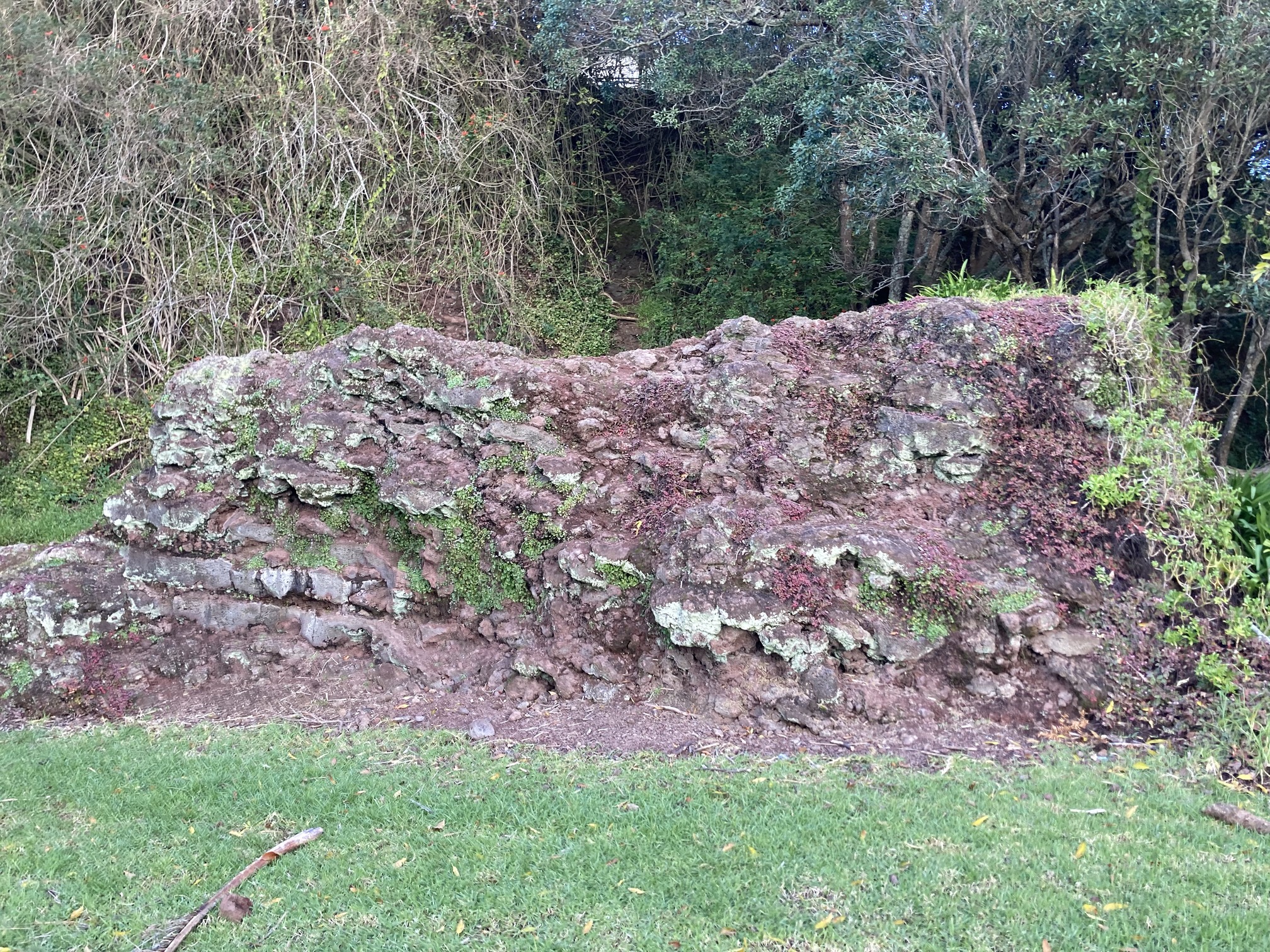
Maungarahiri or Little Rangitoto is (or was) a scoria cone volcano in the suburb of Remuera. It had a peak 75 metres above sea level before it was mostly quarried away, except for a tiny little piece that remains today. A lava flow burst forth from the northwestern base of the cone and flowed north down the valley west of the Orakei Basin tuff ring, and out into what is now Hobson Bay. Part of the lava flow can be seen among mangroves adjacent to the Shore Road Bridge across the creek from the St. Kentigern School carpark, and the toe of the lava flow is buried beneath mud near the Hobson Bay marina.
Our visit

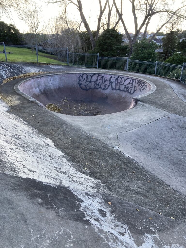
Little Ranigtoto or Maungarahiri is a nice little suburban park in Remuera. It’s got a playground with a flying fox, a rather dilapidated skateboarding area, and (my favourite part) a giant piece of scoria that somehow survived the extensive quarrying.
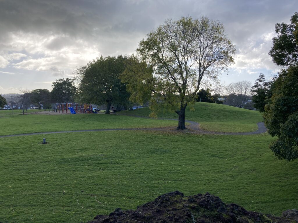
Interestingly, the rolling hills in the picture to the left are not volcanic features, but are apparently built on rubbish. Why, I don’t know. Anyway, it was a good place for a little play and a scoot.
I do not recommend letting the kids go in the skate bowl, unless you’ve a rope in your boot to pull them back out.
Playground aside, Maungarahiri had one most outstanding geological feature (kid for scale).

And here’s the view of Maungarahiri from atop the giant rock. Ōrākei Basin, the 16th volcano in our project, is located off to the right.
Directions and facilities
This park did not have toilets, which I thought was odd, because even on a weekday it was full of families with little kids. Anyway, it’s relatively easy to find at 71 Upland Road, Remuera. There is no official parking, but plenty of space to park on the road. Bring bikes/scooters.
Happy adventuring,